Features Free camping
See where dispersed camping is allowed
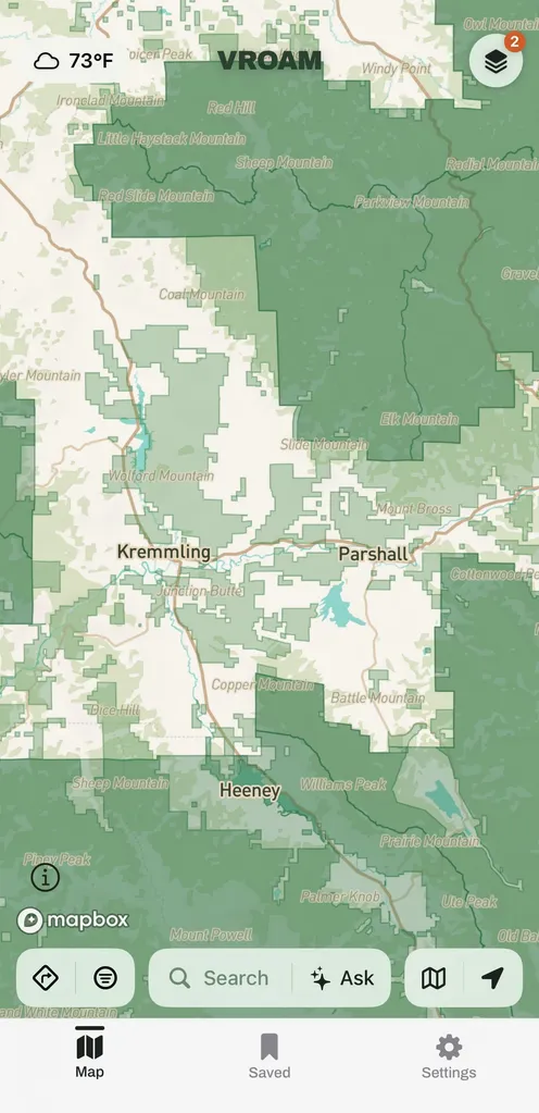
Where you can pull off and sleep for free is not obvious from a satellite photo. Vroam shades the map by land manager, BLM, Forest Service, Park Service, state, and restricted, so you can see at a glance which zone you are standing on before you commit to a spot for the night.
How it works
-
Turn on land shading
Open the Layers panel and turn on the land overlay to see BLM, Forest Service, Park Service, state, and restricted zones colored across the map.
-
Read the zone before you pull off
Tap a shaded area to see who manages it and the general overnight rule of thumb for that zone, plus a nudge to verify locally when the rule is not certain.
-
Confirm on the ground
Posted signs and local rules always win over what the map says, so check them before you settle in for the night.
What makes it different
Vroam shows public land shaded by who manages it, not a small set of user-submitted dispersed pins, because the zone's rules are what actually govern whether you can stay.
What is dispersed camping?
Dispersed camping is free, undeveloped camping on public land outside a designated campground, most commonly on land managed by the Bureau of Land Management or the Forest Service. There are no hookups, toilets, or picnic tables, so you pack in and pack out. Stay limits and local closures still apply, and a posted sign at the site overrides any general rule of thumb.
Common questions
- Is dispersed camping free?
- Yes, on land where it is allowed. There is no camping fee, though you are on your own for water, toilets, and trash, and the land manager sets the stay limit.
- How do I know if a spot is legal?
- Check the shaded zone on the map for who manages the land. Bureau of Land Management and Forest Service land generally allows dispersed camping, while National Park Service land generally does not. A posted sign at the site always takes priority over the general rule.
- Does Vroam show exact dispersed campsites?
- The shading is the general guidance: land by manager and rule, which is the reliable signal for whether you are allowed to stay. Well-known dispersed areas can carry their own pin, and travelers share overnight spots that appear as pins too. Plan from the shading, and treat a pin as a starting point rather than a promise.
Vroam is coming to iOS, with Android in build.
Free to start. Pro is coming after launch.
Notify me at launch