Features Staying connected
Know whether you will have service before you drive there
If you work from the road, "is there service here" is the gate that comes before anything else. Vroam shades the map by carrier so you can see the answer before you drive out there, and puts a per-carrier line on a spot when you open it. It is modeled coverage built from what carriers file with the FCC, not a measured signal, so read it as a well-informed prediction rather than a promise.
How it works
-
Switch on a carrier
Open the Layers panel, find Cell coverage, and turn on Verizon, AT&T or T-Mobile. A carrier shades in its own brand color, and 5G draws more solid than 4G, so you can tell the strong areas from the thin ones at a glance.
-
Read the point, not just the area
Open a spot and Vroam looks up that exact location and shows a Cell coverage row summarising the carriers, a compact line like VZ 5G · ATT 4G. That is the reading for the hexagon the spot sits in.
-
Treat it as modeled
The shading comes from carrier filings, rolled up to hexagons of roughly five square kilometres, so it describes what should work in that area rather than what your phone will show. Terrain, trees, a canyon wall and a busy tower can affect service.
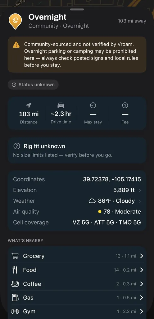
One layer per carrier, same stretch of road
Cell coverage is three separate toggles under Layers, and a carrier shades in its own brand color. These are the same view of central Colorado with a different carrier switched on, which is the whole reason the layer is split up. Modeled coverage from carrier filings, not a measured signal.
-
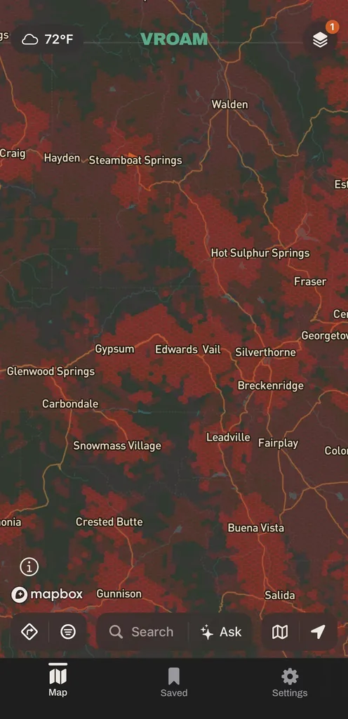
Verizon -
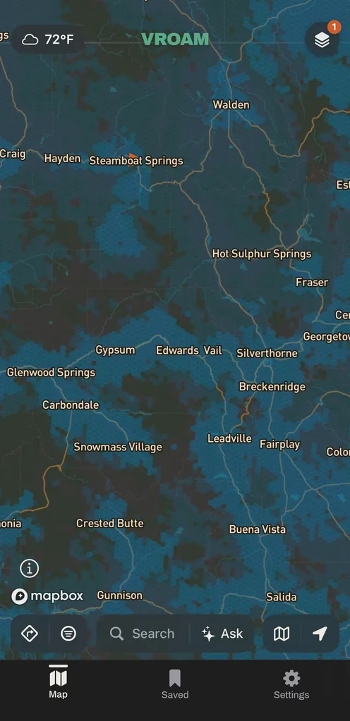
AT&T -
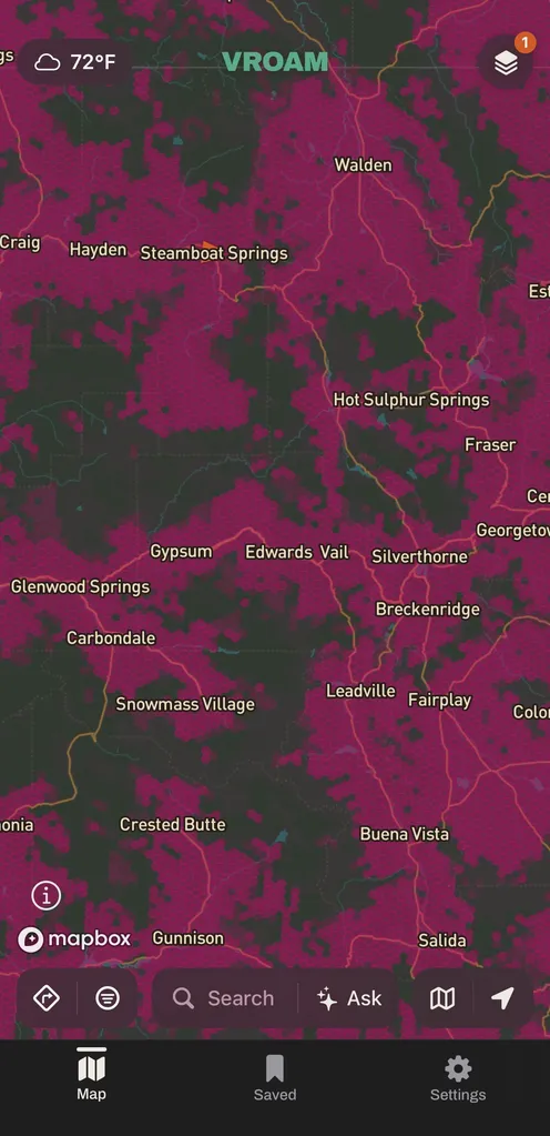
T-Mobile
What makes it different
The coverage question gets answered on the same map you are using to pick a place to sleep, for Verizon, AT&T and T-Mobile, and Vroam says plainly that the data is modeled rather than measured.
What does a cell coverage map actually show?
A cell coverage map shows where a carrier predicts its network reaches, based on what that carrier reports to a regulator rather than on readings taken on the ground. In the United States those reports go to the FCC, which gathers them into national broadband coverage data. Coverage is normally split by network generation, with 5G carrying more capacity than 4G, and it is drawn as an area rather than a point, which is why a hill, a canyon or a stand of timber can leave you with nothing while you are standing inside a shaded zone.
Common questions
- Is the coverage measured or modeled?
- Modeled. It comes from the coverage carriers file with the FCC, rolled up into hexagons, so it is a prediction for an area and not a reading anyone took at that spot. The app carries the same caveat in its Layers panel.
- Which carriers does it cover?
- Verizon, AT&T and T-Mobile, in the United States. There is no US Cellular, no separate reading for a resold or prepaid plan riding on one of those networks, no satellite service and no roaming.
- Will it tell me how many bars I will get?
- No. It shows whether a carrier models 5G, 4G or nothing for that area. Real signal depends on terrain, foliage, weather and how loaded the nearest tower is, so treat a shaded area as a good bet and keep your expectations honest.
Vroam is coming to iOS, with Android in build.
Free to start. Pro is coming after launch.
Notify me at launch